Day 11
Skaftafell National Park and Kirkjubæjarklaustur
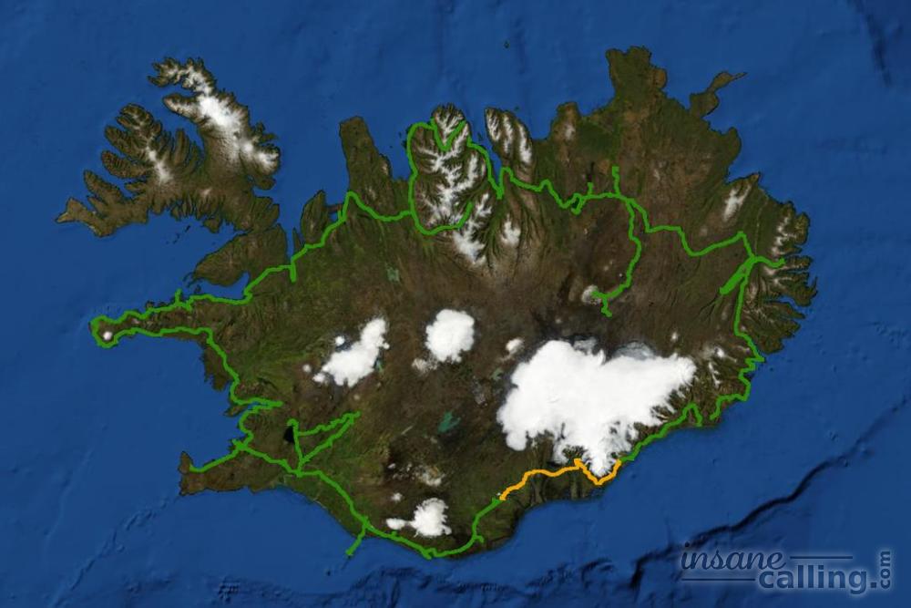
Driving along the south coast of Iceland, you witness diverse landscapes. The ring road curves around various glacial tongues. The Skeiðarársandur beach reveals hints of devastation from past volcanic eruptions. Skaftafell allows you to explore the mighty Vatnajökull national park and see its hidden gem, the Svartifoss waterfall. Lastly, you notice why Kirkjubæjarklaustur, a little village of just 120 people, has carved a niche of itself in the tourist track.
Skeiðarársandur
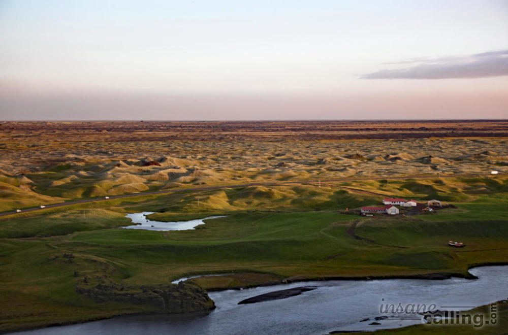
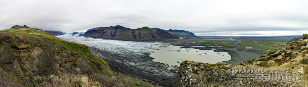
The drive from Fjallsárlón to Skaftafell was through another windy area requiring full control of the steering wheel. The black sandy beach of Skeiðarársandur kept us company. Thousands of river branches flow through the beach. The area was not easily accessible for years since bridges were not easy to build over such sand. Infact the last section of the ring road was built here in the mid 1970s making this area accessible. However, the 1996 eruption of Grímsvötn volcano had caused a huge glacial meltdown that swept away ice boulders the size of a house damaging three bridges in this area. Just like how a subsea earthquake gives rise to fears of a tsunami, a sub-glacial eruption causes fear of glacial outburst. It shows you how volatile and vulnerable the country is under the forces of nature.
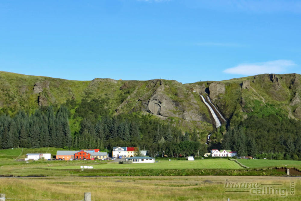
We made a quick detour to the little village of Hof before continuing to Skaftafell visitor centre.
Skaftafell
Skaftafell was a national park of its own until it was absorbed into the Vatnajökull national park in 2008. Today Skaftafell has a visitor center which is the most accessible of the the Vatnajökull national park’s visitor centers. We got a trail map in the visitor centre and had a quick bite at the adjacent cafe and set off on a trail.
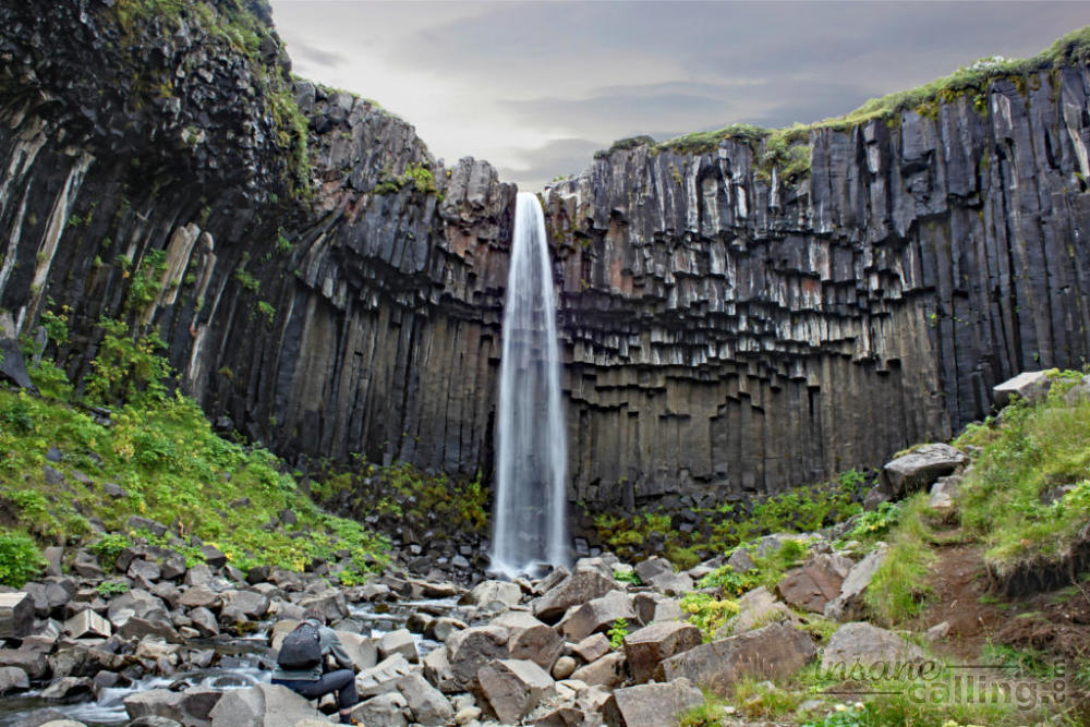
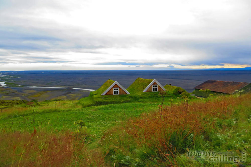
There is a wide range of trails in the National Park ranging from 3 to 30 kilometres. We took a combination of trails that took us Sjonarnipa, a viewpoint with views over the Skaftafellsjökull glacier, Svartifoss and finally Sel, a small abandoned settlement of traditional farmhouses from 1912. Interestingly the forest we were walking in had such short trees that it is funny to even call them trees. This reminded us of an Icelandic joke which went something like this:
Question: What do you do when lost in an Icelandic forest?
Answer: You stand up!
The trails have a lot of loose gravel which means you have to watch your path carefully to avoid twisted ankles.
Kirkjubæjarklaustur
70 km west of Skaftafell is Kirkjubæjarklaustur (Klaustur, in short). There are two places that make this little village worthy of a stop.
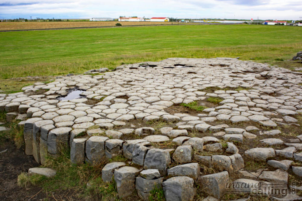
First is the Kirkjugólfið, a small area of naturally formed basalt columns which look like tiles laid on the ground. Even though these columns are formed geologically, there are myths that the columns are the remains of church tiles.
Second place of interest in Klaustur is the Systrafoss (Sister falls). The falls itself were unimpressive and looked more like water glided over the cliffs instead of “falling” but there is a short hike up the cliff to the Systravatn lake and the surrounding meadows. The hike takes you through part of the largest private forest in Iceland. Some of the tallest trees in Iceland are growing in this area. The trees were planted by local farmers who were fighting soil erosion in the 1940s.
Once at the top of the cliff, watching the meadow and the lake during sunset, I felt like I had walked into a wallpaper. If that is not enough motivation to climb the cliff, then the remarkable view of thousands of pseudo craters has to do it. And the word remarkable is an understatement here.