Day 14
Golden Circle
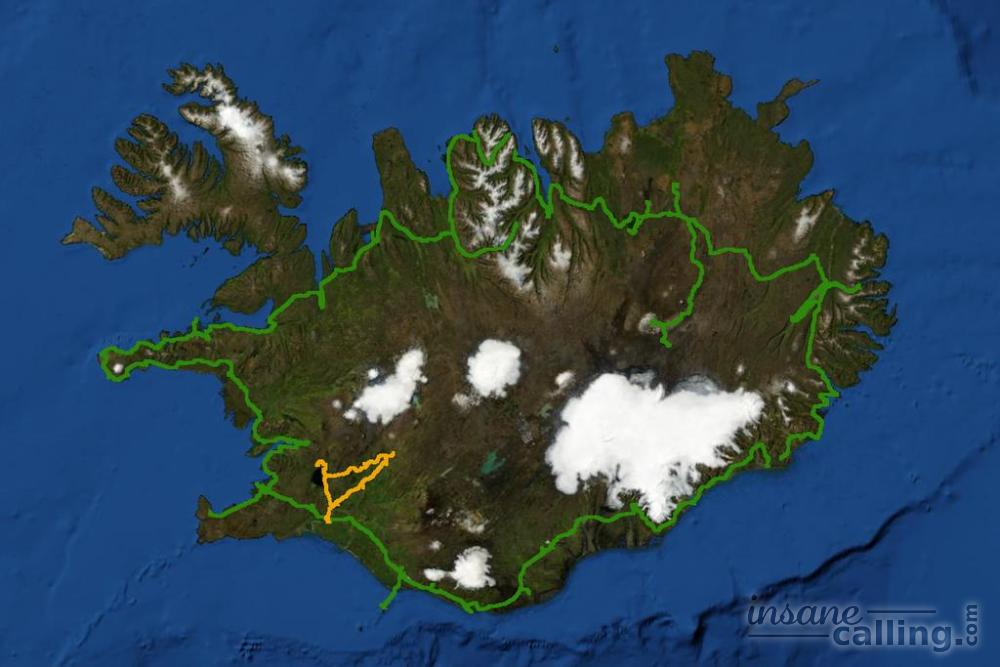
Golden circle is a popular 300 km loop, traditionally made from Reykjavík. Its highlights are the Geysir, Gullfoss waterfalls and Þingvellir National Park.
But we started our Golden circle from Selfoss (as it was more direct than going from Reykjavík) and went anticlockwise.
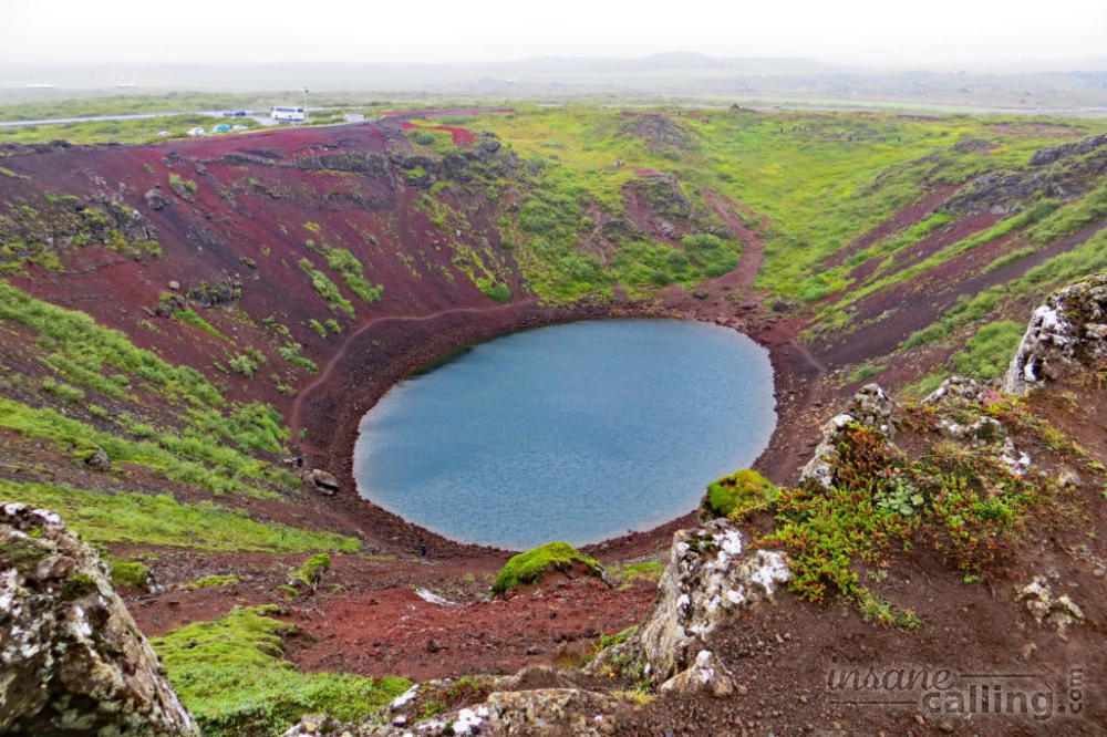
Kerið crater
The first stop on our Golden Circle was the Kerið crater. We were surprised that there is a small entrance fee involved since this was the first natural attraction we had to buy a ticket for. The crater is 6500 years old. The depth of the crater lake ranges from 7 to 14 metres. What is interesting is that the water in the crater is at the same level as the groundwater table. So the depth of crater lake is an indication of groundwater levels. Having seen a couple of craters by now, Kerið was nothing to write home about (at least in terms of visual appeal).
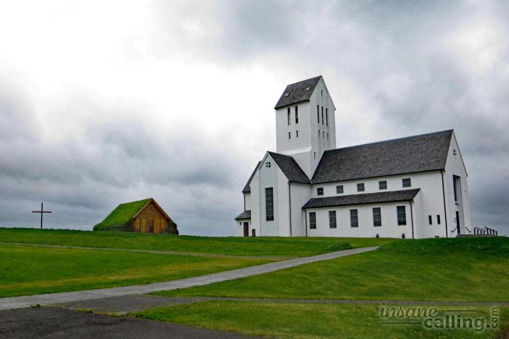
Skálholt
We made a spontaneous detour to Skálholt, a small settlement of religious importance. It is located south of Reykholt. It has a modern church and a turf roofed church facing each other. The large modern church has a cellar with a museum. There is also a small archaeological site just outside the church.
Skálholt was the cultural, religious and political center of Iceland for 700 years from the 11th to the 18th century. Skálholt, along with Holar in the north, was one of the two “episcopal sees” (a sort of headquarters for the catholic bishops) in Iceland. Several churches were built here shortly after Christianity was adopted in Iceland in the year 1000. The downfall of Skálholt started when the last Icelandic catholic bishop was beheaded here in 1550 during Reformation. A fire in 1630 and a earthquake in 1784 destroyed several buildings. The archeological site shows the remainder of some of these buildings.
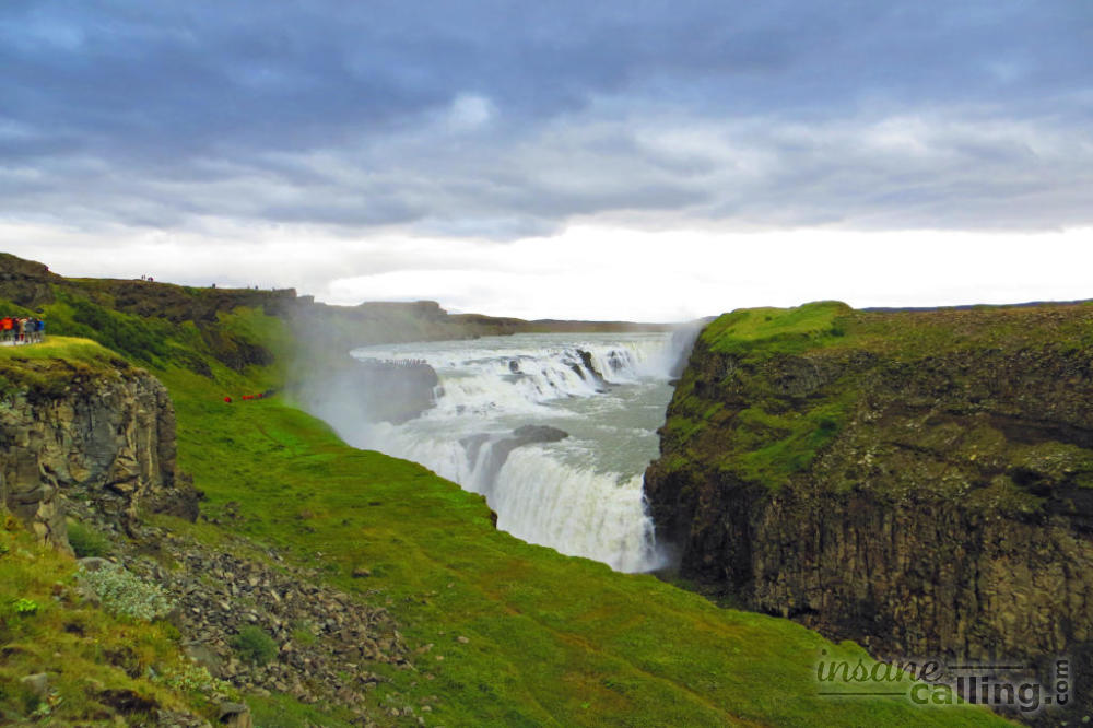
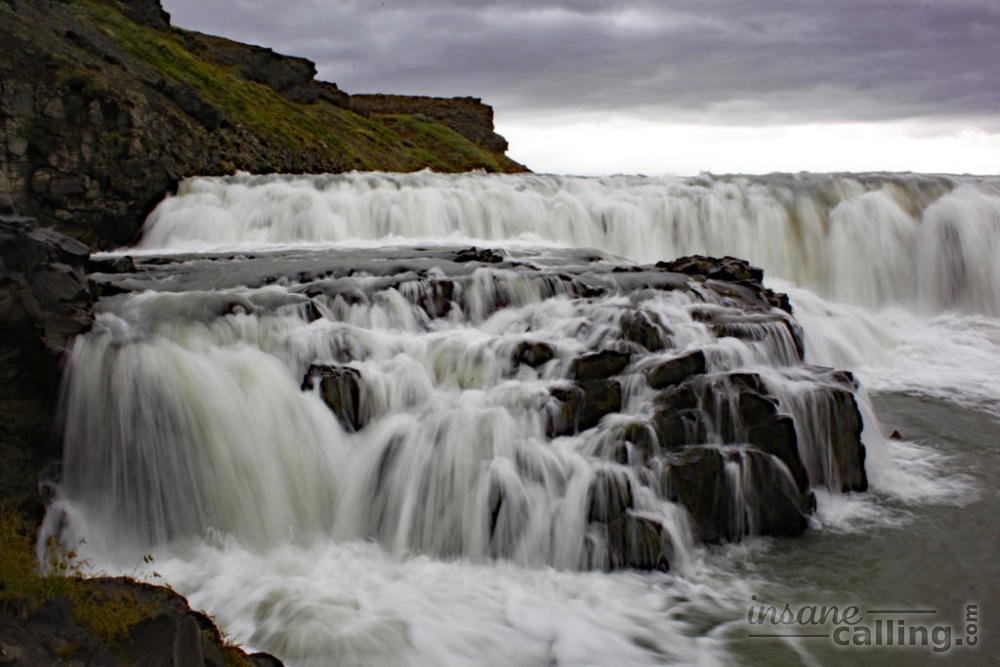
Gulfoss
This was the last of the “celebrity” waterfalls we would see in Iceland. It is a set of double waterfalls, one below the other, stacked in different angles. The source of the waterfalls is the aptly named Hvítá (white) river which originates 40 km north of Gullfoss in Langjökull, Iceland’s second largest glacier.
Gullfoss has a heroine’s story behind it. In the early 1900s as interest in harnessing the power of Gullfoss to generate electricity grew, an Englishman approached a farmer to buy the waterfall. The farmer, Tómas Tómasson, owned the surrounding land and with it the waterfall. He willingly rented the waterfall to the Englishman. But his daughter, Sigriður Tómasdóttir, was vehemently against it. She had grown up around the waterfalls, guiding visitors and even laying the first paths to the waterfalls. She tried to invalidate the rental agreement. She took on the most powerful and richest men in the country single handedly and fought a long and hard battle to prevent any construction. She hired a lawyer, Sveinn Björnsson (who later became Iceland’s first prime minister), to fight her case. She was so passionate about her cause that under dire circumstances, she even threatening to jump in the waterfall if construction began. She lost the court case but luckily the contract was dissolved due to lack of rental payments. In 1940, Sigriður’s son acquired the land from his grandfather and sold it to the Icelandic government.
Geysir and Strokkur
Geysir is the most popular, well…geyser in the world. It has lent its name to all “spouting” hot water springs.
But what is not well known is that Geysir has been dormant for decades. Every once in awhile a earthquake in the region revives it temporarily. The last revival was in the year 2000. Geologists had put in soap water to keep it “alive” but to no avail. Today putting anything inside these springs is forbidden. It still doesn’t prevent the odd tourist from throwing in a coin.
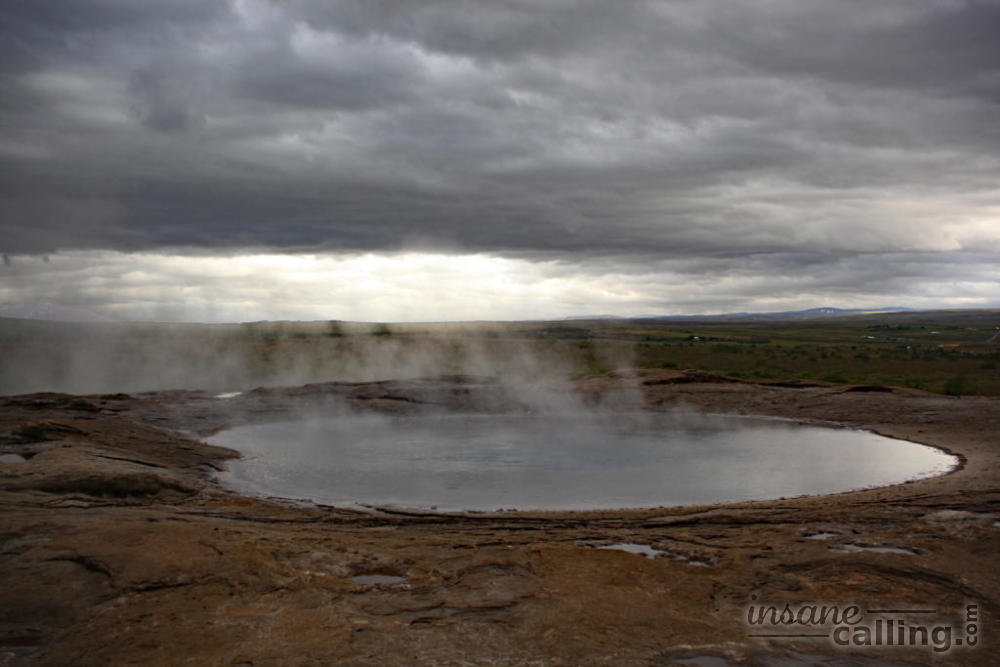
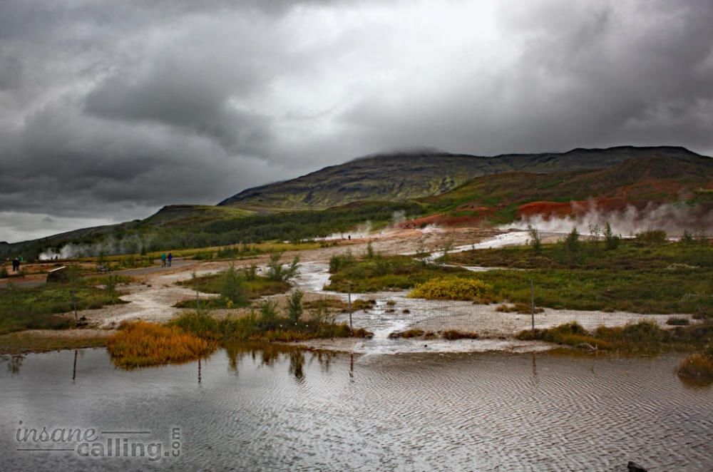
But thankfully Geysir is not the only geyser in the area. Since it is located in a geothermally active area, there are various other fuming holes and smaller dormant springs.
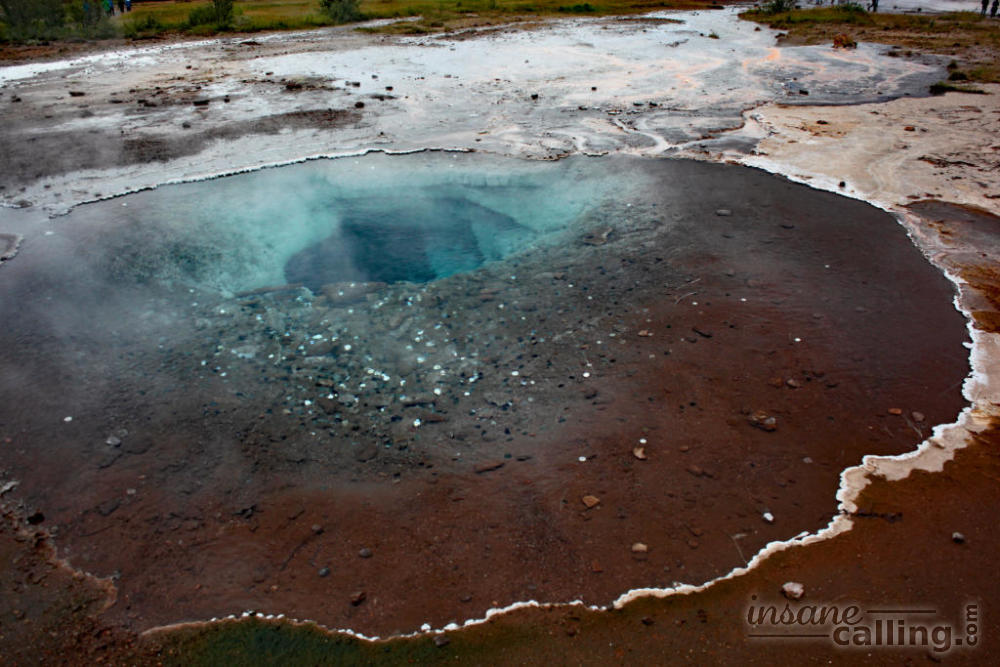
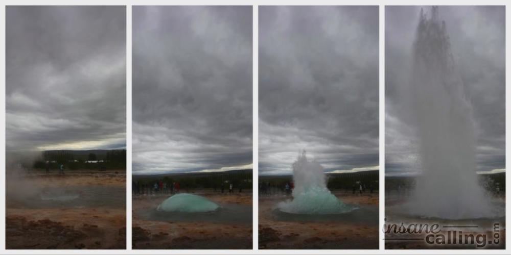
But the star attraction is the Strokkur which erupts every couple of minutes. It was really cool to watch the momentum build up, a large bubble form before the climactic eruption which shoots up water for up to 30 meters. As this took place, the visitors cheered just like they would in a football match when the ball nears the goal post and finally a goal is scored. We lingered a little longer just for this ambience.
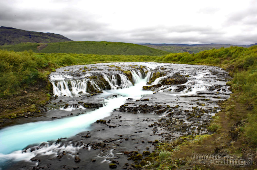
Bruarfoss
The Bruarfoss is a waterfall that is not in the common tourist track (yet!) and therefore not easy to find. It is located between Geysir and Laugarvatn. Though it is miniature in proportions to some of the other waterfalls we had seen, the contrast of the black river bed and the gorgeous blue water had us in awe. We were glad we took the time to hunt it.
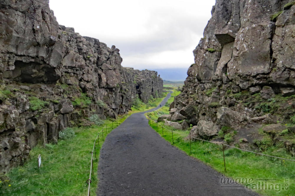
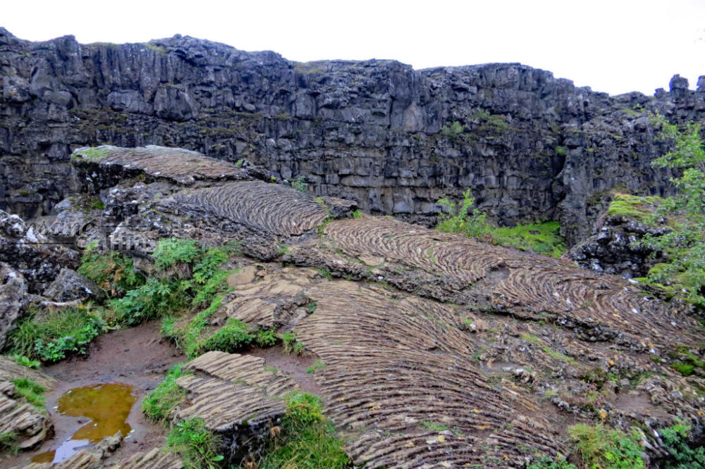
Þingvellir National Park
Our last stop on the Golden Circle was the Þingvellir National Park. The visitor centre had closed by the time we reached and it was extremely windy. So we walked around the Almannagjá rift valley formed by the drifting of the European and American tectonic plates. The rift provided us with some shelter from the winds at least. There are plenty of hiking tracks in the park.
Þingvellir National Park is a spot of historical and political importance. Þingvellir means assembly fields. It is said that this is where the various local chieftains used to assemble for annual parliamentary meetings from 930 to 1798. The meetings were held outdoors and used to attract large crowds. It used to be a major social event for the Icelanders. The meetings were dissolved for 45 years after which they moved to Reykjavík.