Day 6
Myvatn
The Myvatn area in northern Iceland is one of the major highlights of Iceland. It is evidence of the raw power of nature. It is all about lava and geothermal heat. You just have to get used to a steady swarm of flies in summer and the characteristic smell of hydrogen sulphide. Luckily most of the sights are clustered closely together and if you are tight on time, a day is sufficient to see them. But there are plenty of trails to keep you here longer.
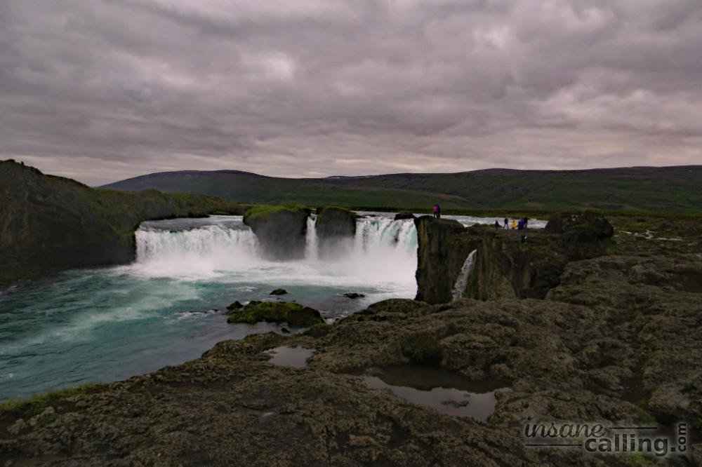
Goðafoss
Goðafoss is the first on a long list of must-see waterfalls in Iceland. It is located near the ring road, halfway between Akureyri and the Myvatn area.
It has a very interesting name. Goðafoss means waterfall of the Gods. Since the first settlers in Iceland were of nordic origin, they worshipped nordic gods such as Óðinn, Þórr (Thor, God of thunder) and Freyja (Goddess of love). Not much after the first settlers arrived, several Christians from Ireland and Norway settled in Iceland. As the nordic region converted to Christianity, the pressure on Iceland to follow suit intensified. In the year 1000, the row on which religion the country should follow had reached its peak and a decision had to be made.
In an assembly session divided into two factions, one wanting to maintain the pagan traditions and the other wanting to follow Christianity, it was decided by the law speaker (presiding assembly official), Þorgeir Ljósvetningagoði, that the future of the country will be better if only one religion was followed. Christianity was chosen. Thus, Iceland’s decision to convert to Christianity was more political and swift rather than through slow preaching by missionaries. Following the decision, people who were not baptised had to do so. Consequently, Þorgeir threw his pagan idols in the waterfall resulting in its name, Goðafoss, waterfall of the Gods.
You can read the full story in detail here.
Reykjahlíð
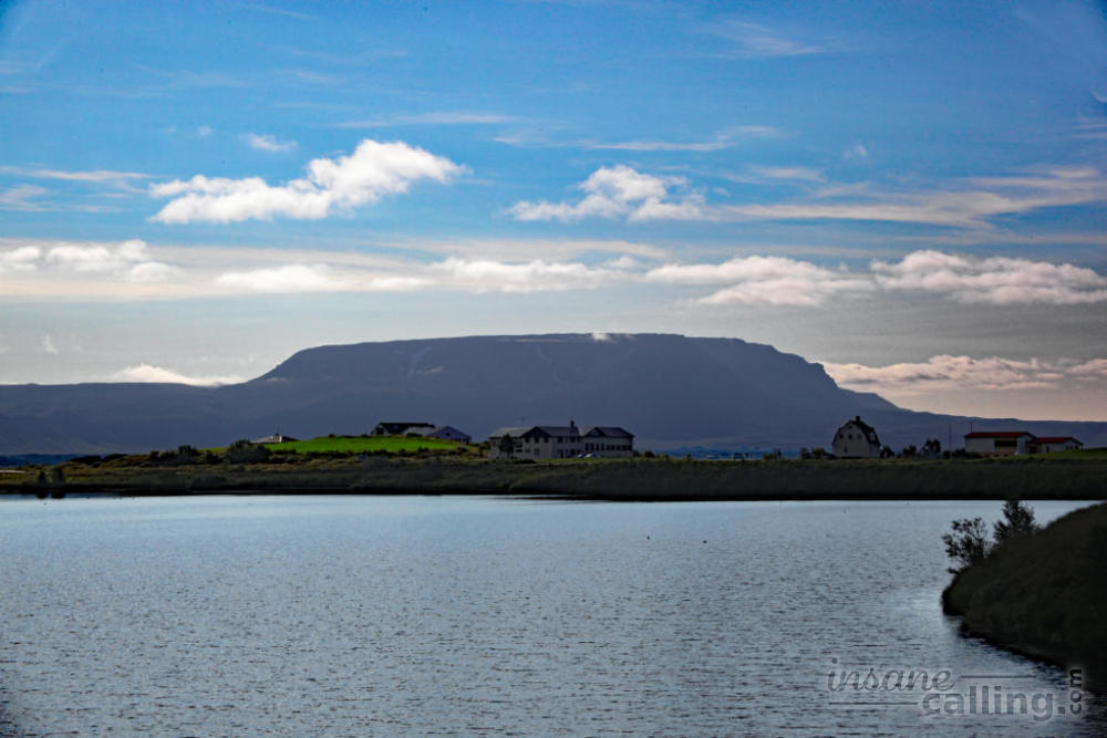
Reykjahlíð is the only village in the Myvatn area and the ideal base for exploring the wild subterranean world that Myvatn is famous for. Myvatn means lake of the midges. We learnt why very soon. Shortly before entering Reykjahlíð, we noticed clouds of flies surrounding people. This particular variety of flies is known as midges. These midges are there for the warmth of your breath. You notice them crashing like raindrops on the car’s windshield. During our stay here, I have inevitably and unwillingly breathed in a few of them, eaten a few of them and had a couple enter my eyes. It is a bit of a nuisance in the summer and I couldn’t imagine doing any hikes here to be a pleasant experience. Hats with nets are sold in the super markets. The locals consider it a matter of pride and resilience to not wear such hats. Apart from that, Myvatn was the one area where we had blissfully warm and sunny weather.
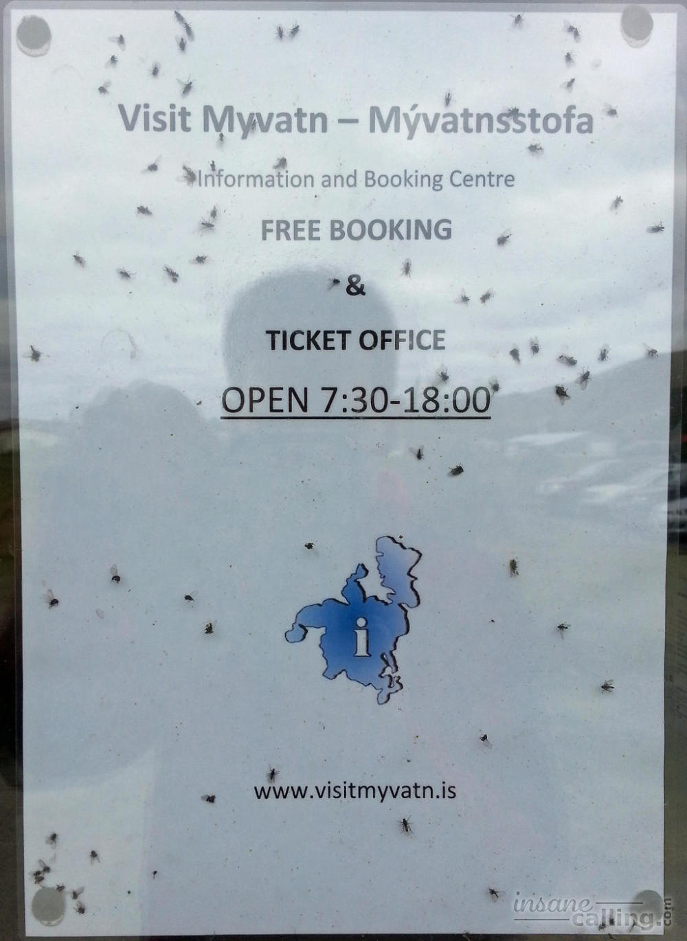
The tourist information centre in Reykjahlíð, is one of the best we have seen. The ladies there were very helpful and friendly. They can book tours for you and during peak season they have a list of the number of beds available that night for each accomodation in town.
There is a string of geological sights in the Myvatn area. This is where Iceland made me realize that the geography I learnt in school was a primitive introduction to what actually happens under our feet. Iceland doesn’t just have volcanoes; it has volcanic systems. Craters are not just concave tips of volcanoes from where lava once erupted. There are craters, pseudo craters, calderas and other concave dips on mountains. They can be formed by steam explosions, release of gas or collapses of magma chambers. All of these can be filled with rain water, glacial meltdowns and ground water to form lakes or remain dry! The possibilities are endless.
# Quick tip: Check out the Vedur.is website for their list of earthquakes in the last 48hours! They report minor quakes pretty much on an hourly basis.
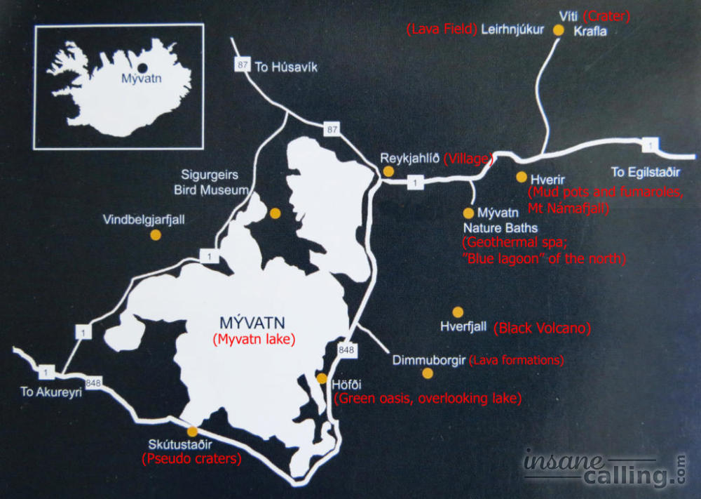
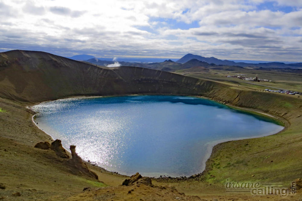
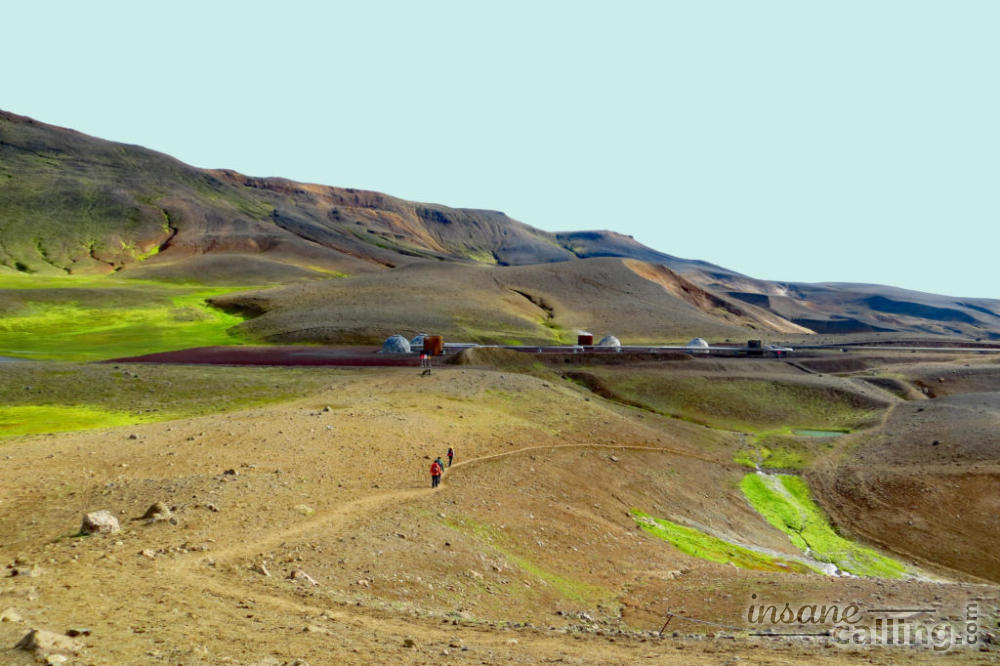
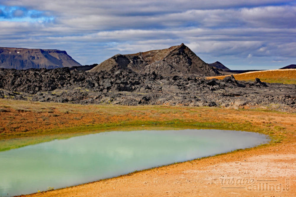
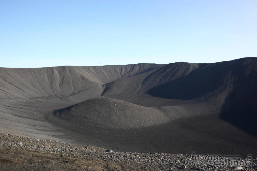
Viti crater
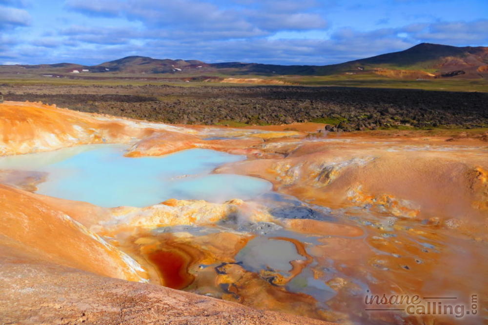
We visited the cluster of sites located to the northeast of Reykjahlíð, first of which was the Viti crater. The Krafla volcano looms behind the crater. The crater was formed in an explosion in 1724. It is an uphill walk to the rim of the crater, but once there, it is possible to circle it and view the lake and surroundings from all angles. There is a lot going on near the crater and we were intrigued by its surroundings. There are mini ponds or potholes with turquoise waters. A waft of air brought with it some strange fumes. We followed the smell and were led to an area of “colourful soil”. Each colour in the soil represents a chemical compound. For example, red represents iron oxide; white represents silicon dioxide; bluish grey represents iron sulphide and yellow represents sulphur.
The area is geothermally very active. You will notice geodesic domes dotting the landscape around Krafla. The domes are to cover drill holes that extract geothermal heat. More information on the geothermal energy is available in the Krafla visitor centre.
Leirhnjúkur
Leirhnjúkur means clay hill. It is a hill with a large lava field surrounding it. There are walking trails that take you around fuming lava fields, mud pools and cloudy to turquoise water. It is surreal!
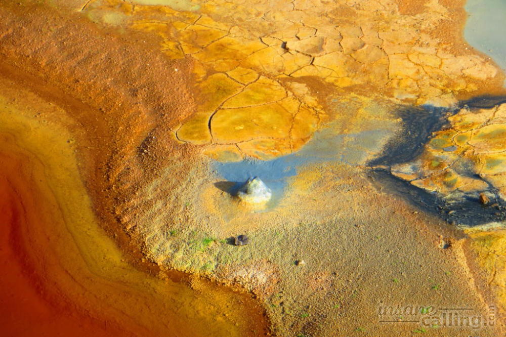
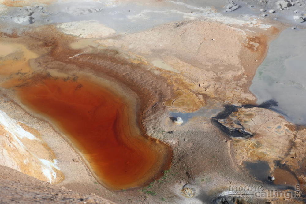
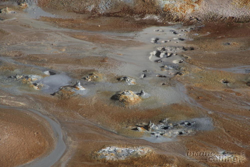
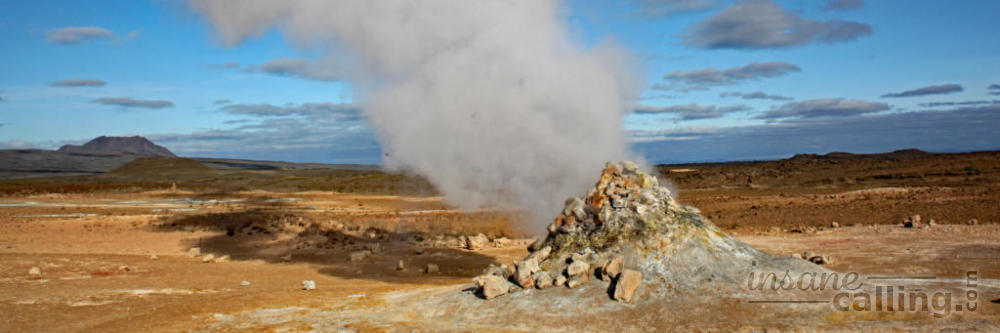
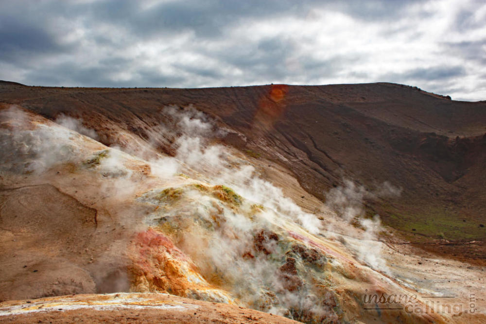
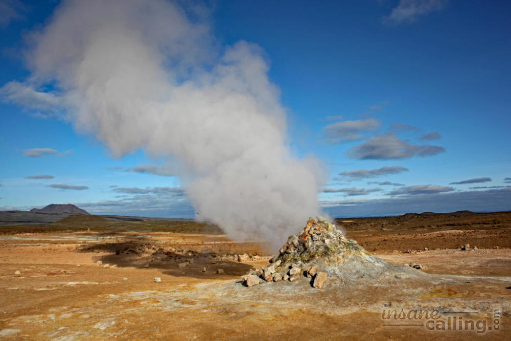
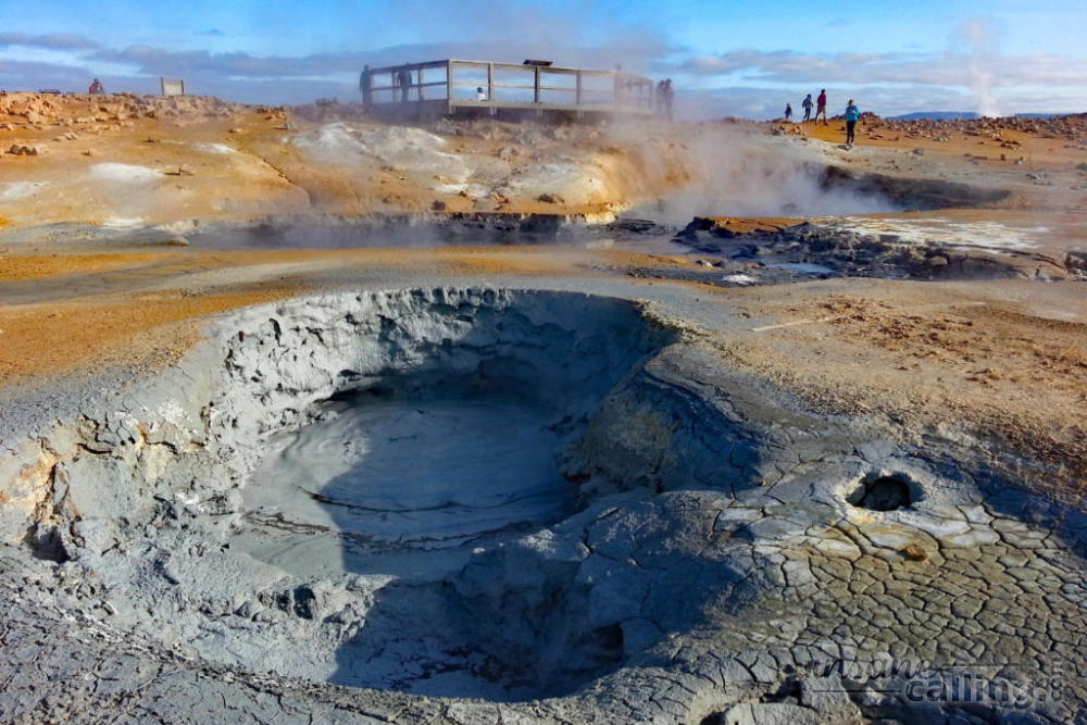
Hverir and Námafjall
Hverir is a geothermally active, high-temperature area (80 to 100 degrees Celsius) with fumaroles, orange mud, bubbling grey mud pots and the strong smell of hydrogen sulphide. Sulphur was mined in Iceland centuries ago to produce gunpowder. Walking around the area sounds and smells like you are in an overzealous chemistry lab and it looks like you are on alien land. Námafjall is a mountain overlooking this area with walking trails. But we had enough hills to climb for the day.

Hverfjall
South of Reykjahlíð is Hverfjall, a large black volcano with a disappointingly empty sandy crater. A landslide during the eruption, 2500 years ago, caused the cone to be a asymmetrical. A straightforward 20 minute climb takes you to the rim of the crater. You can also choose to walk the 1 km diameter of the crater. From the rim of the crater you get panoramic views of the surroundings including that of the pseudo craters in Myvatn lake.
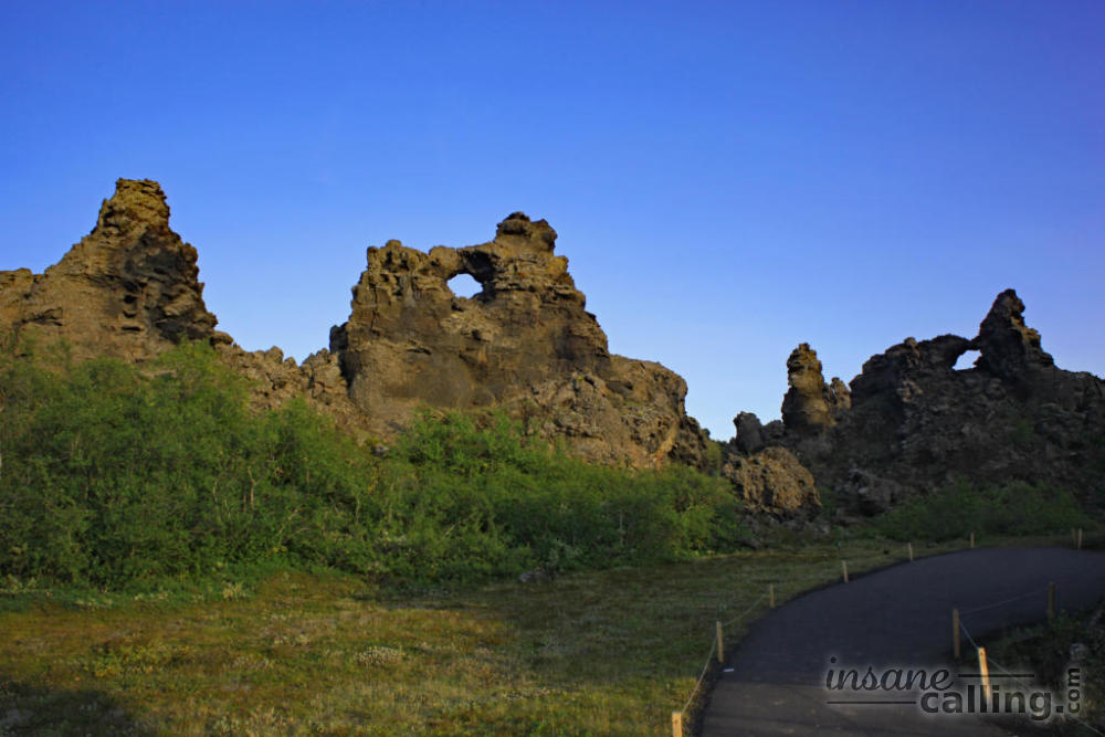
Dimmuborgir
Not far from there Hverfjall is Dimmuborgir. Dimmuborgir is a lava field with interesting lava formations of various shapes and heights. It was similar to the lava we saw around the black beach of Djúpalónssandur in Snæfellsnes peninsula. The major difference was that Dimmuborgir felt a lot more touristy and almost man-made in comparison because of the addition of paved paths and even a cafe and toilets.
Höfði
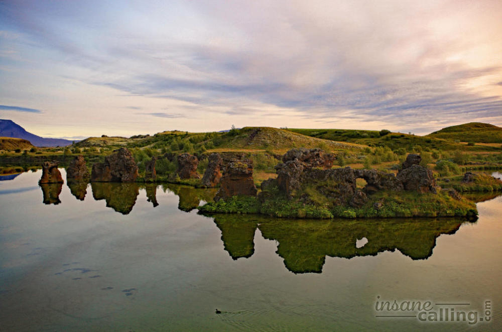
Watch the sunset in Höfði which is a green oasis among all the volcanic activity. Very peaceful with pleasant views over the Myvatn lake and its various lava formations. The Myvatn lake is also well known for its bird life.
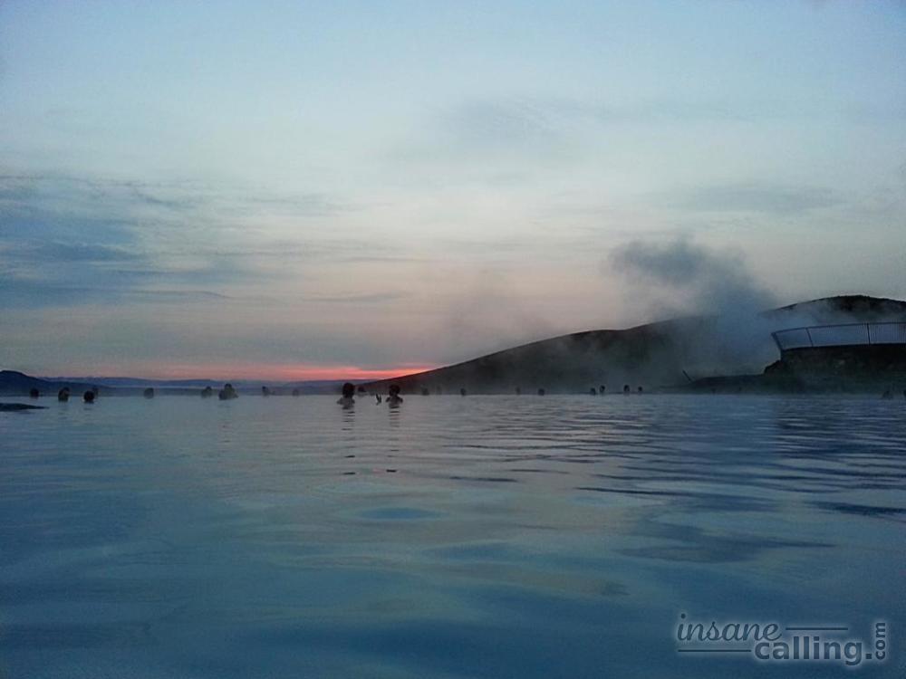
Myvatn Nature Baths
A perfect way to end the evening is in the Myvatn Nature Baths, a geothermal spa. It is the less expensive and less crowded version of the Blue Lagoon. The lagoon water is a by-product of the nearby geothermal power plant.
It takes a couple of minutes to get used to the murky smell of the water. But once you do, you wouldn’t want to leave. It was magical to watch the evening sky, the moon and a shooting star all in the span of two hours through the steamy waters.
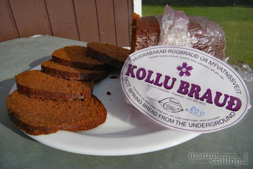
Before you leave the Myvatn area, do try the sticky and slightly sweet rye bread baked underground by geothermal heat. It is available in a plastic bucket in the Reykjahlíð supermarket or if you are in time, get a fresh (and still warm!) loaf from the handicraft store next to the tourist information office.