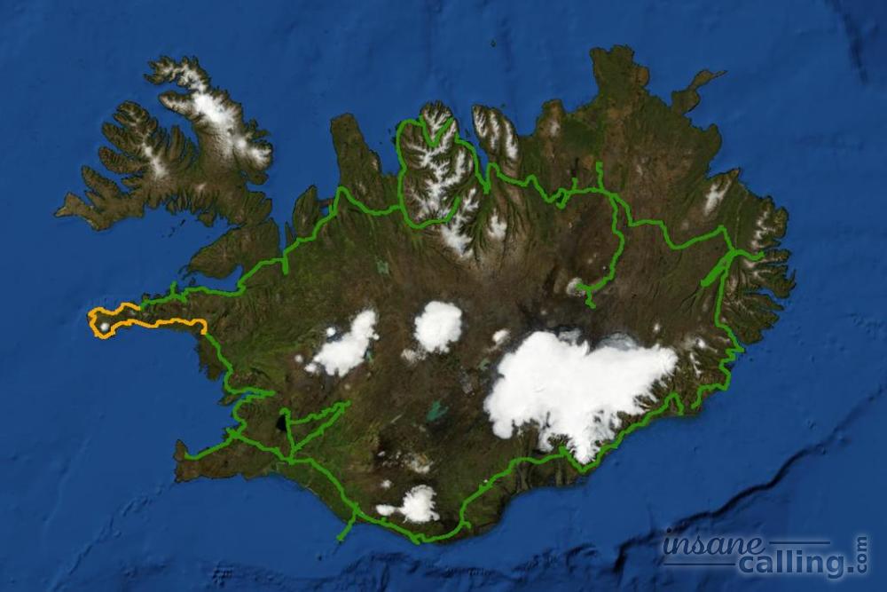
Day 3
Snæfellsness Peninsula
The 200 km drive along the peninsula is like a crash course on Iceland. It gives you a taste of what the rest of the country has to offer. It is one of the windiest areas in Iceland. Outlining the peninsula are several former fishing villages and seaside cliffs perched with lighthouses. From black pebble beaches to mountains trickling with waterfalls for as far as the eye can see, the diversity of landscape is immense. Here is why the Snæfellsnes peninsula should be included in your Iceland itinerary.
Our day started with reading the weather warning for winds of up to 70 km/hour. Snæfellsnes peninsula and in particular, its south coast get extremely windy. The north coast is less so because it is partially protected by the mountains. We were thankful that at least it wasn’t raining because no umbrella is built to survive those winds.
Most of your journey will be on the Snæfellsnesvegur (54). As you drive towards the peninsula, you get the first glimpse of lava fields. We stopped our car countless times and photographed it not knowing that lava fields much more impressive await us along the ring road.
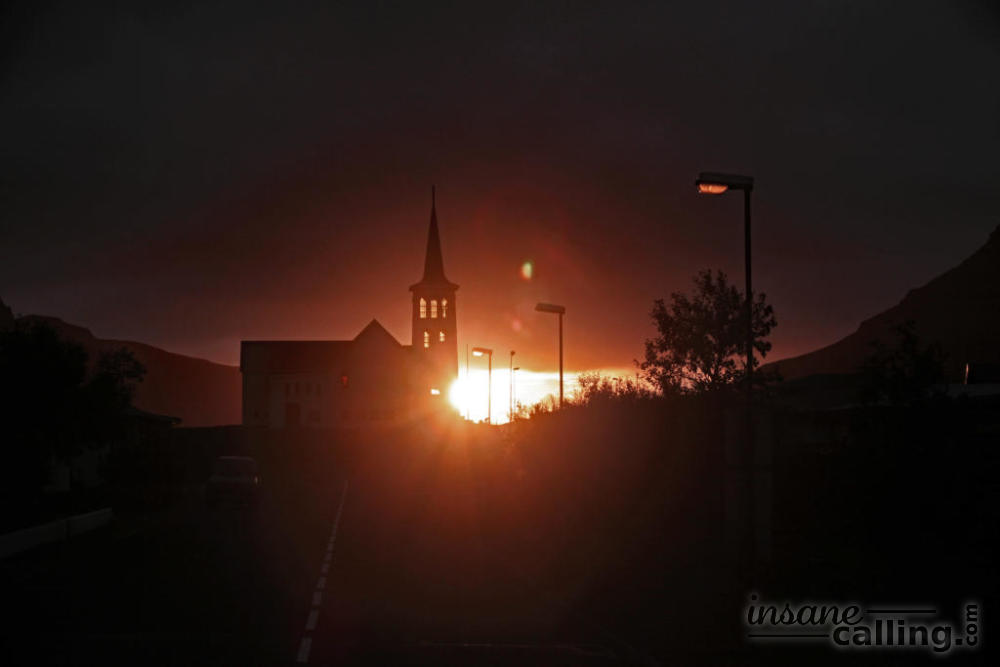
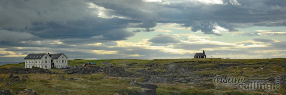
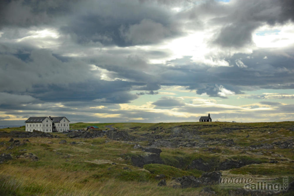
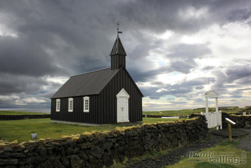
Búðir
Búðir is an abandoned fishing village on the south coast of the Snæfellsnes peninsula. Apart from a hotel and the church, there are no houses here. As we exited the Snæfellsnesvegur and approached Búðir, we saw a sandstorm by the beach and the sight of seagulls fighting the wind. The black and white church of Búðir is beautifully perched on the coast and is visible from far. Once out of the car, I had to use every vertical surface possible to anchor myself against the blowing wind and not be gone with the wind, literally. There are marked walking trails here but need I say why we didn’t venture?
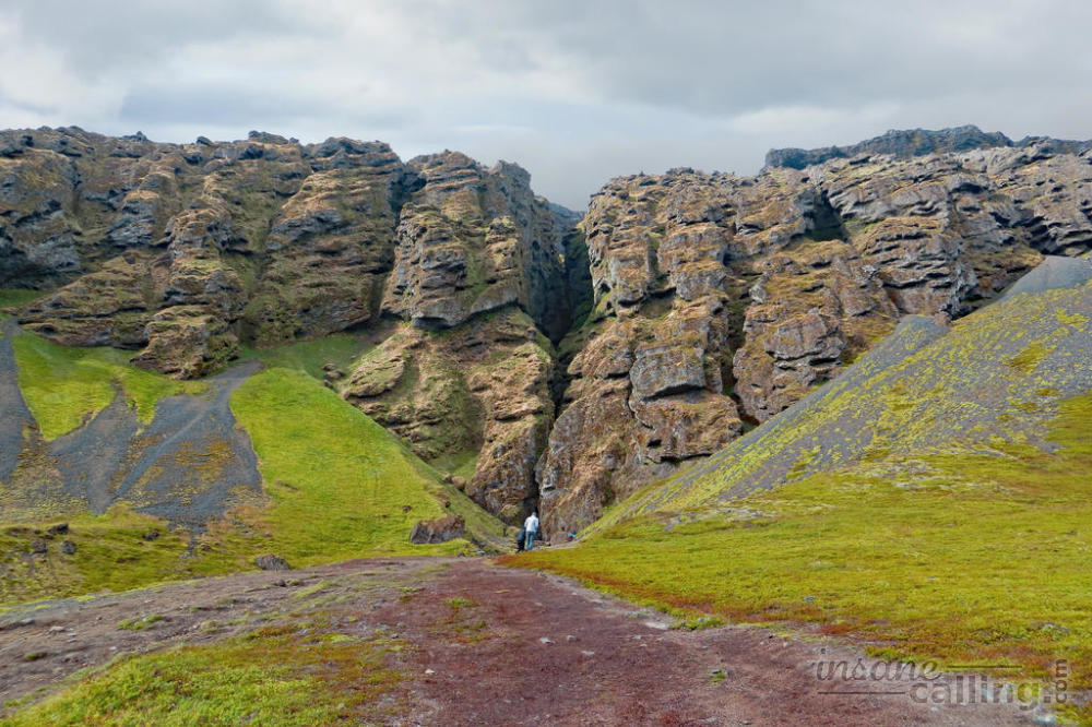
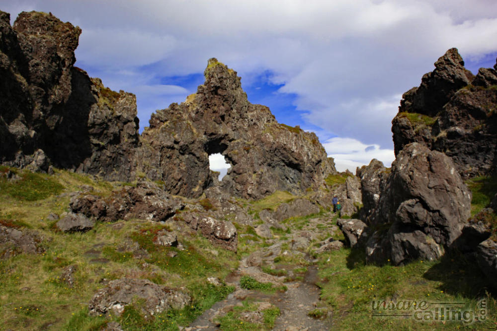
Rauðfeldsgjá
Rauðfeldsgjá is a mountain fissure with a waterfall at the end. We had a peek through it but didn’t walk all the way because that included the risk of getting wet. It is located between Búðir and Arnarstapi. We knew about the existence of Rauðfeldsgjá but we couldn’t find it on our maps. Luckily, the car park is visible from the Útnesvegur and it was busy. Busy car parks are a common way to find out when there is something worthwhile to check out.
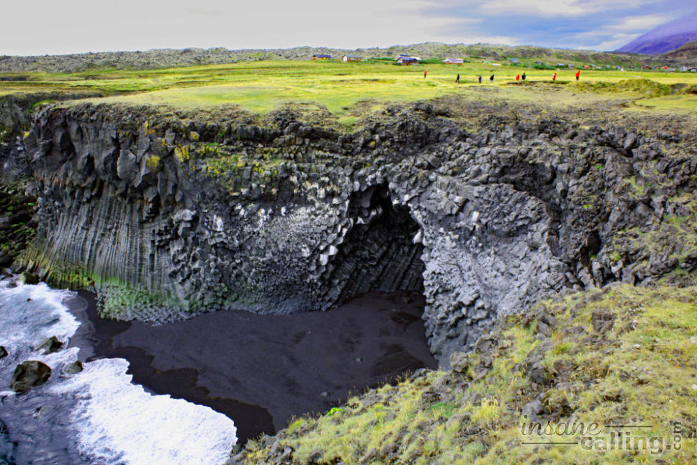
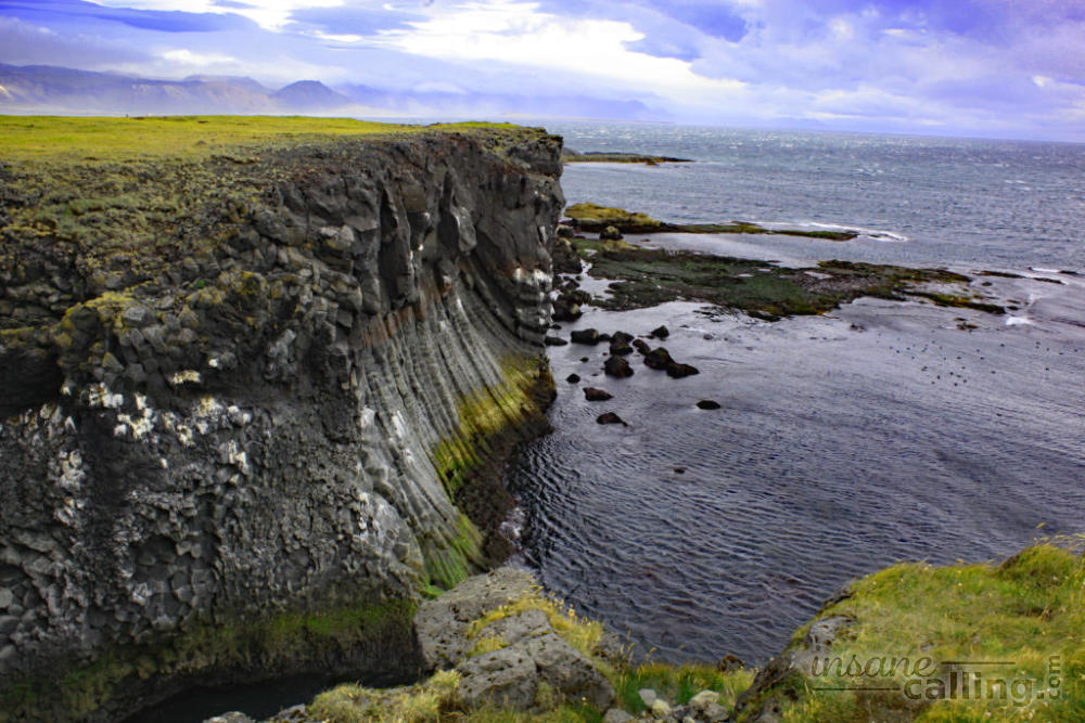
Arnarstapi and Hellnar
Arnarstapi is a fishing village located 18 km west of Búðir. Head towards the beach and you will notice stunning rock formations and caves along the coast. You can also walk from here to the next village of Hellnar along the coast. We would have loved to do this if only we could walk and not be flown away.
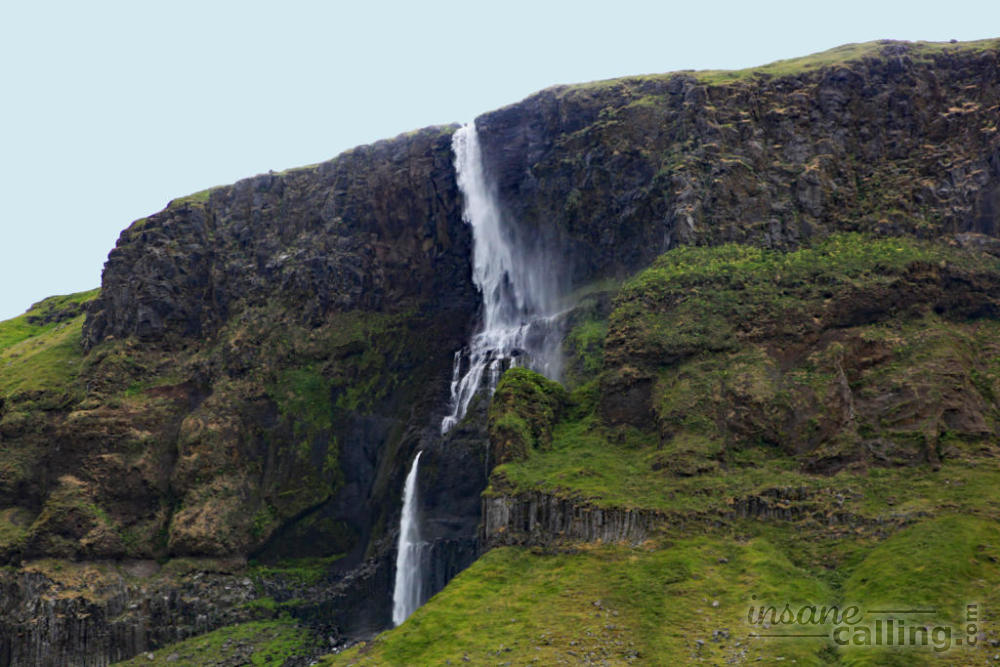
The road is as picturesque as it gets. Seashore on one side and large imposing mountains with plenty of waterfalls on the other side. By this point, we had stopped pointing out waterfalls to each other because the country has more waterfalls than trees.
Many a times, we saw winds overrule gravity and sway the direction of waterfalls. A waterfall in this part of windy Iceland should perhaps be called a water-fly because it flies more than it falls.
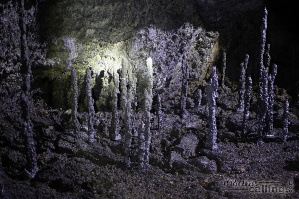
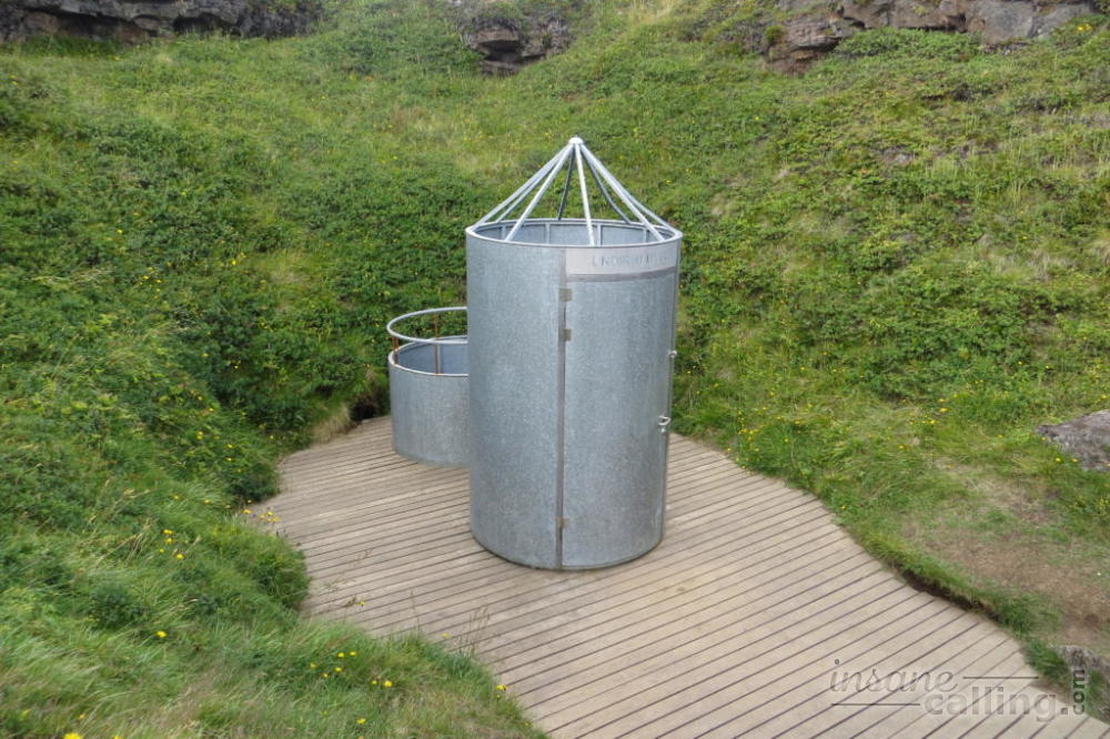
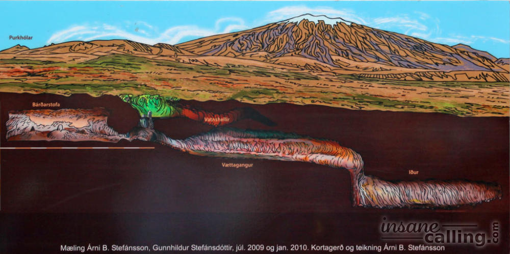
Vatnshellir cave
Ten minutes from Hellnar on the Útnesvegur lies the Vatnshellir cave. There is no specific address for this place, just like many other places in Iceland, except that it is on the Útnesvegur between the Hellnar and Djúpalónssandur. It is hard to miss it. There is a congregation of cars at the parking area along the road. The 8000 years old cave is located in Snæfellsjökull national park. The cave was formerly free to enter until tourists decided to take the stalagmites as souvenirs and did other damage. It was closed and reopened with guided tours. You get to see two chambers of the caves that are 35 metres deep. We recommend you go there because not only is this one of the few affordable guided tours you will get in Iceland but also because the guides were really good and humorous (this can be said about many Icelandic guides though). You also get an idea of how Iceland looks under all that lava. You will be surprised to know that the rugged exterior is actually deceptively fragile.
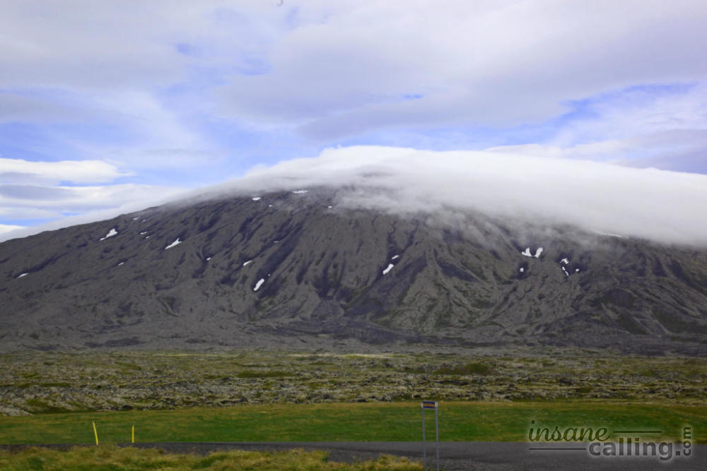
Snæfellsjökull
By this point, you may notice the Snæfellsjökull around which you are driving. It is essentially a big volcanic mountain (1446 metres high) with a glacier on top. The amount of ice at the top has been reducing in recent years and in 2012 there was no ice at all. Jules Verne suggests in his book, The Journey to the Centre of the Earth, that the center of the earth can be reached from the Snæfellsjökull crater. We cannot verify that but we can tell you that Snæfellsjökull cuts a striking picture with the clouds lowering from the top. We took a moment to take it all in. Totally a wow moment.
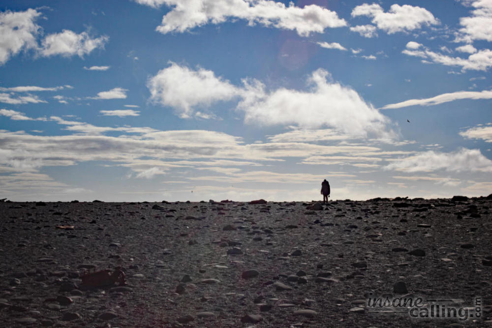
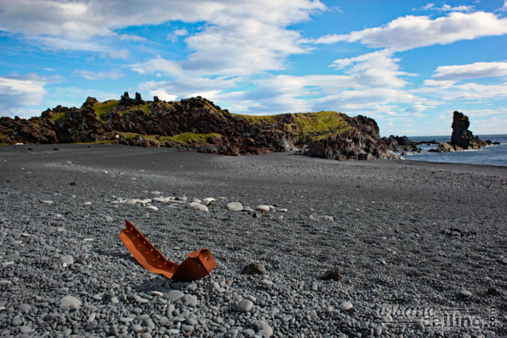
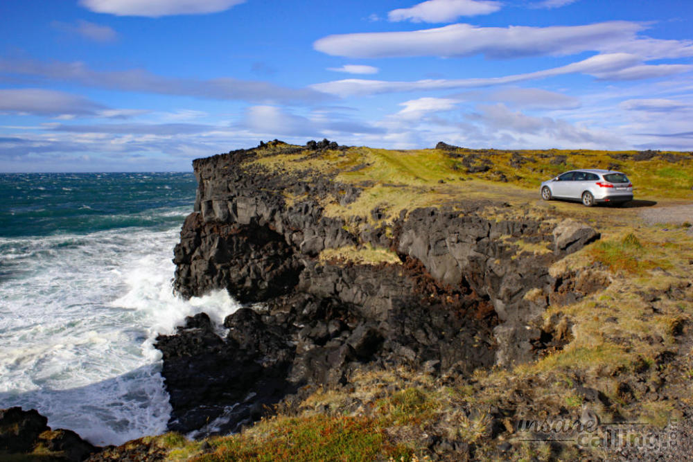
Djúpalónssandur
In the southwest of the peninsula lie the Djúpalónssandur and Dritvík beaches. We visited only the first of the two beaches. It was one our favourite places in the trip. As you walk towards the beach, the otherworldly walls of lava give way to a beautiful black pebble beach. The further you walk towards the shore, the smaller the pebbles get. Providing some beautiful contrast to this scene are the rusty orange pieces of shipwreck from a British trawler that sank in 1948. It is all a little surreal and feels as though time has stood by and the only constant are the crushing waves.
Skardsvik beach
Then continue further west towards Skardsvik beach where the crashing waves dwarf the imposing seaside cliffs. Further on the road is Öndverðarnes if you wish to continue. This would be the westernmost part of the Snæfellsnes peninsula.
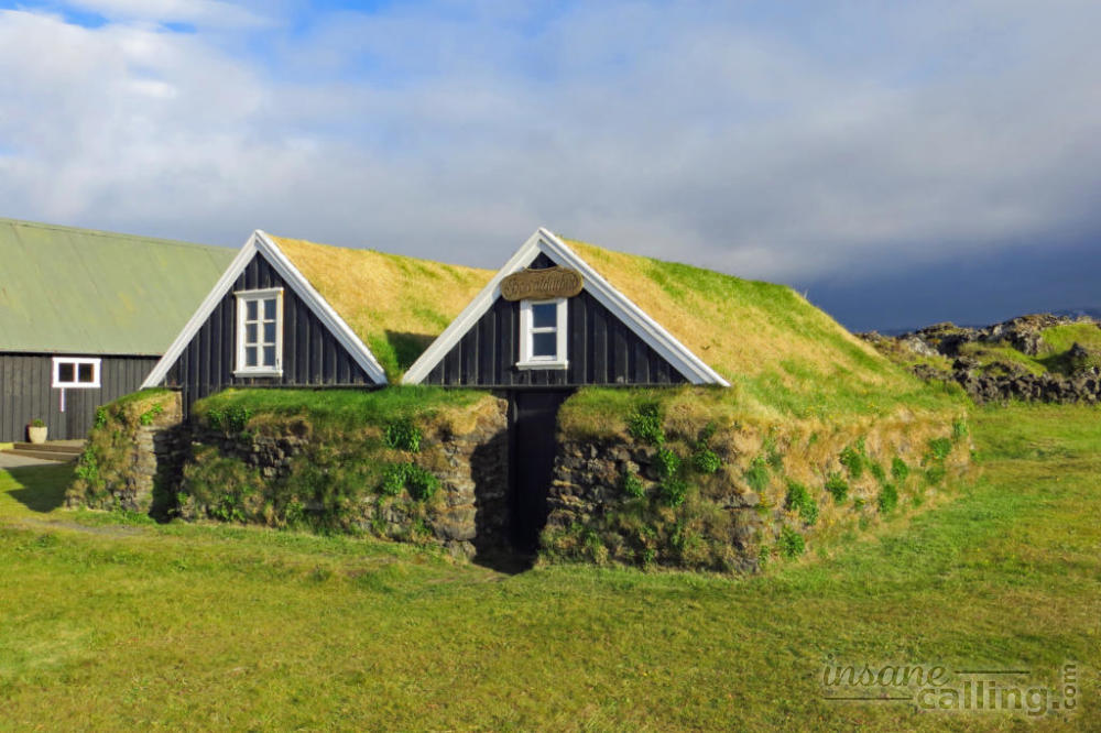
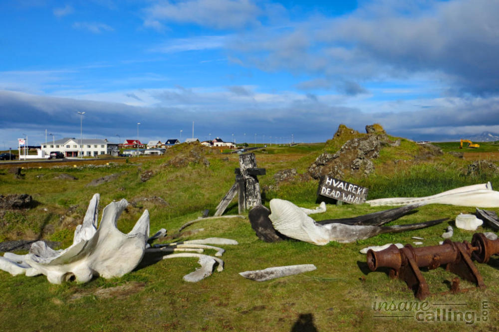
Hellissandur
We moved on to the little settlement of Hellissandur. There is a Fishermen’s garden past the campsite with cute turf houses and whale bones on display. It also has a collection of items which shed some light on life at a time when these villages survived on fishing. It is also a good point to tank fuel and buy some groceries in the mini market next to the gas station.
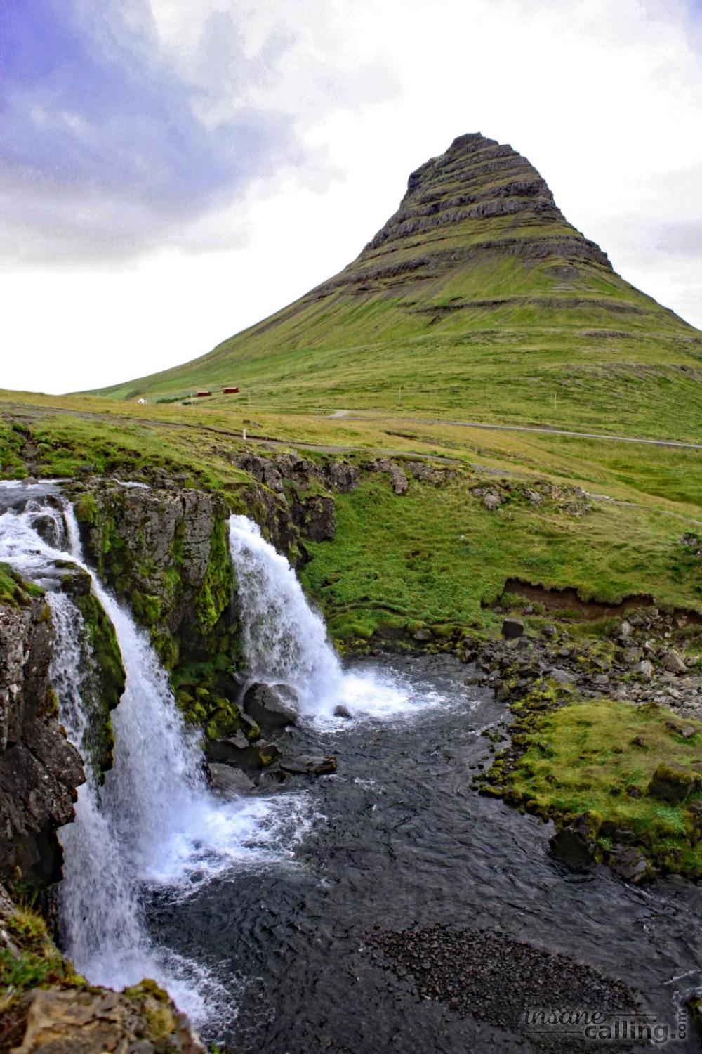
Kirkjufell
32 km east of Hellissandur is the Kirkjufell mountain. For some reason, it is one of the most photographed mountains in Iceland. From the west, it looks like any other table mountain. But from the east, it has a conical shape that is not all that common. A good vantage point is to stop at the Kirkjufell waterfalls.
Grundarfjörður
In the shadows of the Kirkjufell mountain lies the town of Grundarfjörður. The town was established in 1786 by a Danish king and was a commercial centre on the west coast in the early 1800s. It used to have strong links with French fisherman. Nowadays it offers possibilities of whale watching and puffin tours. Walk around the town to get a feel of a modern Icelandic town.